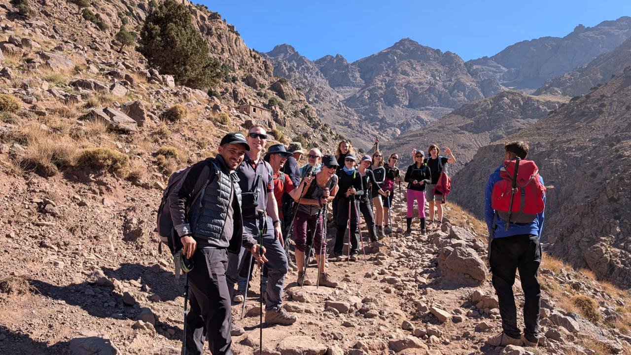
Mount Toubkal is the roof of North Africa, a 4,167 m summit visible from the plains of Marrakech on clear winter days. Before you climb it, it is worth knowing the mountain: where it is, how high it really is, who first climbed it and what lives on its slopes. Here are the essential Mount Toubkal facts, in short, verified-style answers you can rely on when planning.
Mount Toubkal facts at a glance
| Fact | Answer |
|---|---|
| Height | 4,167 m (13,671 ft) |
| Range | High Atlas, Morocco |
| Status | Highest peak in Morocco, the Atlas Mountains and North Africa |
| Distance from Marrakech | About 60–70 km south (around 1.5 h by road to Imlil) |
| Usual starting point | Imlil village, about 1,740 m |
| Base | Toubkal refuges, about 3,200 m |
| First recorded ascent | 12 June 1923, by the Marquis de Segonzac, Vincent Berger and Hubert Dolbeau |
| Protected area | Toubkal National Park, created in 1942 |
| Summit marker | A metal pyramid-shaped tripod |
| Normal route difficulty | Non-technical trek in summer; winter mountaineering with snow |
How high is Mount Toubkal?
Mount Toubkal is 4,167 metres (13,671 feet) high, according to the commonly accepted measurement. It is the highest mountain in the Atlas range and in North Africa, and one of the most prominent peaks in the world, rising far above the surrounding plains. Older maps sometimes give slightly different figures, such as 4,165 m, but 4,167 m is the standard reference today.
Where is Mount Toubkal?
Toubkal lies in the western High Atlas of Morocco, south of Marrakech, inside Toubkal National Park. The nearest villages are Imlil and Aroumd on the northern side, and Amsouzart and the Tifnoute valley on the southern side. Most visitors reach it by driving from Marrakech to Imlil via Asni, then walking up the Mizane valley to the refuges.
Who first climbed Toubkal?
The first recorded ascent of Toubkal took place on 12 June 1923, by the French Marquis de Segonzac with Vincent Berger and Hubert Dolbeau. Local Amazigh shepherds and hunters had almost certainly reached the high slopes long before, but this was the first ascent documented in writing. Today tens of thousands of trekkers attempt the summit each year.
Toubkal National Park
Toubkal National Park was established in 1942, making it the oldest national park in Morocco. It protects high mountain landscapes, juniper forests, alpine meadows and traditional Amazigh villages. Key facts:
- It covers the Toubkal massif and surrounding peaks above 4,000 m, including Ouanoukrim.
- It includes Lac d'Ifni, one of the few natural mountain lakes of the High Atlas.
- Villages continue to farm terraces, graze animals and use traditional irrigation inside and around the park.
- Visitors are asked to stay on trails, carry waste down and respect local communities.
More background is available on the Toubkal National Park Wikipedia page.
Geology and landscape
The Atlas Mountains were uplifted by the collision between the African and Eurasian plates over tens of millions of years. The Toubkal massif is built largely from very old volcanic and crystalline rocks, which explains its dark, jagged ridges and huge fields of scree. Glaciers shaped the high cirques during colder periods of the past; today there are no permanent glaciers, but snow can cover the summit from roughly November to April.
Climate on Toubkal
| Season | What to expect at the summit (approx.) |
|---|---|
| Summer | Mild days, cold mornings around 0–10 °C, strong sun, possible afternoon storms |
| Autumn | Clear, cooler days; first snow possible from November |
| Winter | Snow and ice, temperatures well below freezing with wind chill |
| Spring | Melting snow, changeable weather, cold nights |
Wildlife and plants
Despite the harsh environment, Toubkal's slopes are alive. You may see Barbary ground squirrels, choughs circling the summit, birds of prey above the ridges and, in spring, cushions of thorny plants and wild flowers. Lower down, walnut trees, barley terraces and juniper woodland frame the villages. The park has also worked to protect native species such as the Barbary sheep (aoudad).
The people of the Toubkal valleys
The valleys around Toubkal are home to Amazigh (Berber) communities who have lived in the High Atlas for centuries. Villages such as Imlil, Aroumd, Tacheddirt and Amsouzart are built from stone and earth, with flat roofs used for drying crops and terraces carved into the slopes. Families grow barley, maize, potatoes, apples and walnuts, keep goats, sheep and mules, and move herds to high summer pastures where they stay in stone shepherd huts called azibs.
The local language is Tashelhit, a variety of Tamazight, and most people also speak Moroccan Arabic; many guides add French and English. Tourism has become an important source of income since the second half of the twentieth century, through guiding, mule hire, guesthouses and small shops, but agriculture remains central to village life. Weekly souks in towns such as Asni bring the valleys together to trade produce, animals and household goods. Trekking with local guides and staying in village gîtes is the best way to understand how people live in this demanding mountain environment.
Interesting Toubkal facts trekkers love
- On very clear days, the summit view stretches across the High Atlas towards the Anti-Atlas and Jbel Siroua in the south, and over the Haouz plain towards Marrakech in the north.
- The shrine of Sidi Chamharouch, on the way to the refuges, is a pilgrimage site; non-Muslims do not enter the shrine itself.
- Two refuges stand side by side at about 3,200 m, the base for nearly all summit attempts.
- The classic return trek from Imlil involves about 2,400 m of ascent and descent.
- Toubkal is popular as a first high-altitude summit for trekkers who later go to Kilimanjaro or the Alps.
Comparing objectives? Read our French guide Toubkal ou Kilimandjaro.
How do people climb Toubkal today?
Most trekkers climb Toubkal on a guided 2- or 3-day trek from Imlil, sleeping one or two nights at the refuge. A licensed guide has been required since 2019. Longer itineraries add Amazigh villages, Lac d'Ifni and high passes for better acclimatisation. Popular options include our 2-day Toubkal trek, the 3-day Toubkal summit trek and the 6-day Toubkal circle trek.
The busiest periods are spring (April–May) and autumn (September–October), when the weather is usually stable and temperatures are pleasant. Summer brings many visitors too, while winter attracts mountaineers and ski tourers looking for snow on North Africa's highest summit.
Key takeaways
- Mount Toubkal is 4,167 m high, the highest peak in North Africa.
- It lies in Toubkal National Park (1942), south of Marrakech, reached via Imlil.
- First recorded ascent: 12 June 1923.
- Non-technical in summer, a mountaineering climb in winter snow.
Ready to see the facts with your own eyes? Contact our team to choose your Toubkal trek, or read our summit day guide.